Lore about the Salton Sea claims that it was an engineering mistake in the early 20th century, after officials dug canals from the Colorado without anticipating the consequences. The truth is, it has been there for thousands of years. Though not to this capacity. Unfortunately, the resulting pollution was humanity’s fault.
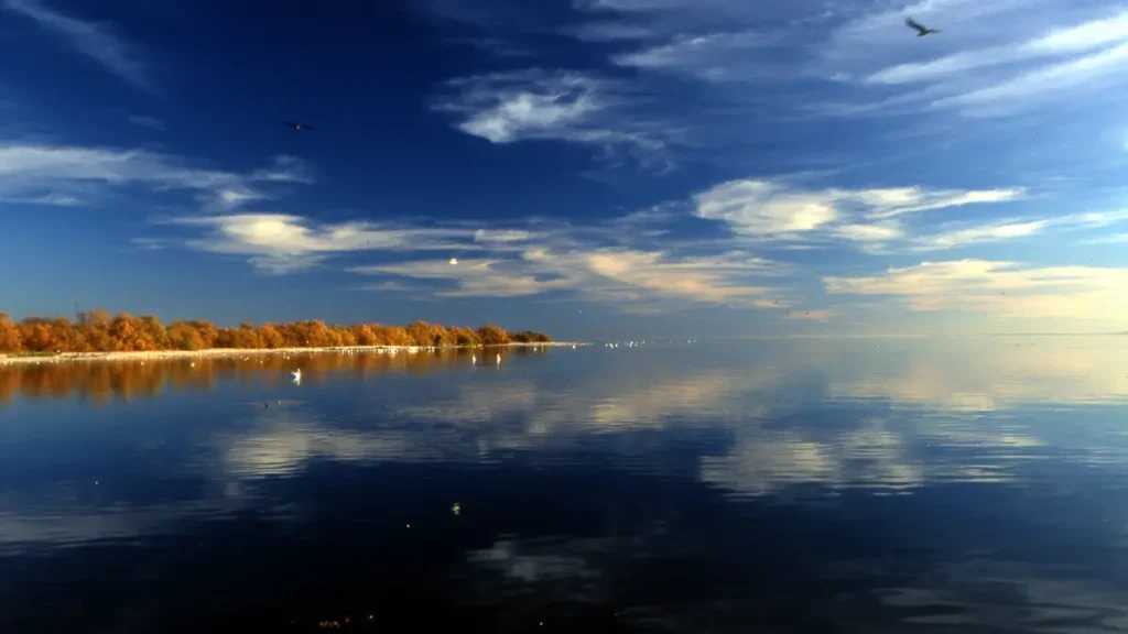
Located in Southern Riverside and Northern Imperial County, the Salton Sea is the largest lake in California. The current version was created between 1905 and 1907, following the collapse of Colorado floodwaters that flowed into the Imperial Valley’s irrigated lands.
These overflowed for 1 year and 6 months, creating new rivers and flooding an area known as the Salton Sink.
The initially believed origin story was that engineers cut an irrigation canal without a headgate, so the Colorado River broke through the bank and flowed into the desert basin. This supposedly resulted in the 400-square-mile lake that no one planned for.
The truth is, before irrigation canals or settlers in the area, the Salton basin was already filling up and emptying itself for years. This lake is not a mistake that the desert had to tolerate. Rather, it was something the environment kept leaning into and trying to recreate.
The basin is located in the Salton trough. This is an active fault zone set between the San Andreas to the east and the San Jacinto fault to the west. The trough is a landward extension of the same geologic rift that created the Gulf of California.
If it were not for the Colorado River delta piling sediment over thousands of years and cutting the basin off from the ocean, then the Gulf of California would be as far as Indio.
The Salton Sea covers all of what used to be the northern part of the prehistoric sea. During the previous 15,000 years, the Colorado River oscillated back and forth over the delta.
After the natural path to the Gulf of California was blocked by silt, it changed course. This resulted in floodwaters covering the Salton basin.
Eventually, the waters covered the entire basin, forming what was known as Lake Cahuilla. Over time, the lake dried and refilled before finally drying up after 1580. Native tribes known as the Ivilyuat settled around the lake.
Between 1618 and 1638, the lake reformed again after the Colorado River diverted waters from the Gulf. The river then went on to flood the basin at least eight times during an 80-year period from 1824.
Hence, the events that occurred in 1905 are considered in the geological schedule. Not the story that engineers made a mistake cutting canals without a structure. The flooding of 1905 to 1907 would have occurred regardless of the engineering decisions made by California officials.
The Canal and Flood that Created Today’s Salton Sea
In 1900, an engineer named George Chaffey, working in collaboration with the California Development Company, initiated a project that dug channels from the Colorado River.
His main engineering strategy was to dig a 4-mile channel from the U.S. border to Mexico and to avoid the Algodones Sand Dunes.
The Alamo Canal connected the Colorado River to the Alamo River, using a dry riverbed as the natural canal. Chaffey saved the company thousands of dollars in excavation expenses while also delivering water to the Imperial Valley.
This was a stretch of desert that had been determined to have agricultural potential. The Imperial Valley was receiving water by 1901, and settlers began purchasing land and growing crops, but the issue was silt.
Before it was dammed, the Colorado River was a sediment machine, dumping sand and silt everywhere it went. So the canals kept getting clogged.
In a bid to restore the flow of freshwater to farmers, the CDC engineers cut a new bypass channel through the riverbank in Mexico. There was no control structure at the diversion point. The intention was to set up a headgate later, but that never happened.
Following a period of heavy rain in 1905, the Colorado River swelled. It overran the intake cut and then sent floodwaters down the Alamo Canal.
Within a few weeks, the Colorado River was draining northward into the Salton Sink, rather than southward to the Gulf of California. Then something unique happened. Floodwaters began eroding the desert floor.
These channels dug at the point where the water dropped into the Salton Sink, creating a waterfall. At first, the drop was 15 feet, but as the erosion continued upstream, it became an 80-foot waterfall.
The flood eroded more than 300 million cubic meters of soil and rock as it reshaped the lake’s dimensions. This was not welcome news, of course. The South Pacific Railroad determined that the entire Imperial Valley was in trouble.
They also had big financial interests in the region, so they pushed everything into an intervention.
The company dumped earth into the breach and diverted all rolling stock to the Salton sink. Two thousand workers unloaded railroad cars filled with boulders, wood, and dirt into the flooded canal.
In an effort that took 52 days, the railroad built trestles across the break. They ran a continuous line of 1000 flatcars from quarries dumping giant boulders into the water faster than the water could carry them away.
In February 1907, the Pacific Railroad finally sealed the breach and forced the Colorado River back to its original channel to the Gulf of California.
However, by then, a lake covering 318 square miles was already formed. It had no outlet anywhere. The town of Salton and a Southern Pacific siding were underwater. Almost half of the Torres Martinez Desert Cahuilla Indian reservation was gone.
The remnants of the Cahuilla tribe had to pack up their belongings and move to the mountains as they watched their land submerge.
The Lake Prevails Into a Golden Dream
By all physical logic, the lake should have evaporated over the next few decades. The Salton Trough receives less than 3 inches of rain a year, and evaporation rates are intense.
However, the farmers in the Imperial Valley were able to irrigate their land with ample water, and the excess runoff drained into the lake.
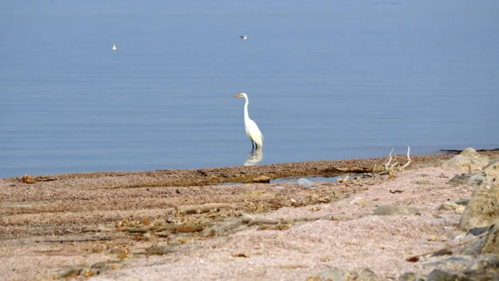
Over the years, waterfowl settled on the lake as it sat on the Pacific Flyway. This is a north-to-south migration route for birds flying between Alaska and Patagonia.
Fish also arrived via the Colorado River water. These included carp, rainbow trout, humpback suckers, and desert pupfish. Later, other agencies began to stock the lake with corvina and croaker.
The reduction in freshwater inputs from the river caused the lake’s salinity to rise. This had a significantly negative effect on the marine life in the river.
To save the lake’s economy, the California Department of Fish and Game stocked the lake with 30 marine species, hoping that some would thrive in this changing environment. Most of them did not, but the Orangemouth, Sargo, and Corvina successfully adapted.
Unfortunately, during the 1970s and 80s, salinity rose above ocean levels, causing a massive die-off of the species. This was because the fish eggs and larvae could not survive in that hypersaline environment.
Tilapia were accidentally introduced in the 1960s and became the dominant species because they are salt-tolerant.
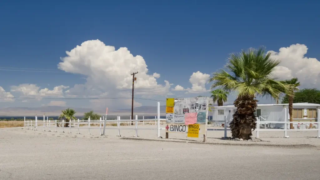
The Salton Sea did get a reputation as a resort destination, and sport fishing grew rapidly. The area drew more than 1 million visitors a year, at its peak, outpacing Yosemite.
Motorboat regattas, yacht clubs, and waterfront restaurants were set up in the 50s and 60s. At the time, the Salton Sea was the California dream at full volume.
The Gradual Decline
The dream had structural issues that no amount of marketing could fix. This lake had no outlet, and everything that flowed into it stayed and coagulated.
Irrigation runoff from the Coachella and Imperial Valleys carried contaminants into the water, including pesticides, fertilisers, phosphates, and nitrates. This caused the sea’s salinity to jump up to 50 per cent higher than that of the Pacific Ocean.
Aside from the fish dying, it also caused massive algae blooms, which also died and decomposed on the lake floor.
The fish dying off led to bacterial blooms, which produced hydrogen sulfide. Later, the smell of rotten eggs wafted far enough northwest to be felt in the Los Angeles basin.
There was also a pelican die-off recorded in 1996. Ken Sturm, a biologist at the Salton Sea National Wildlife Refuge at the time, was patrolling the shallow waters in late summer that year and spotted dead pelicans.
What he witnessed was the beginning of the deadliest pelican die-off ever seen. 15,000 birds in total died. The cause was type C avian botulism, a bacterial neurotoxin. These events were documented and largely ignored.
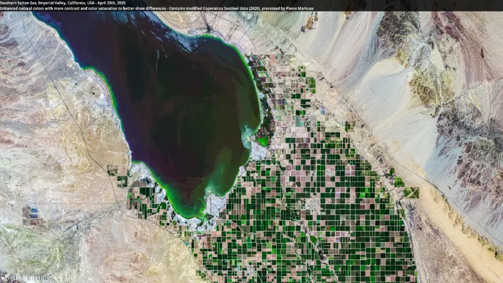
After 2000, efficient water-use methods in the surrounding farmlands reduced flows to the lake. This caused the sea to shrink, exposing the lakebed and decades of agri-chemicals.
These chemicals are linked to asthma, cancer, and respiratory disease cases in the region. The areas surrounding the Salton Sea were already known for the worst air quality in the United States.
People who settled near the shores and were not able to relocate carry the highest rates of asthma in the state. The most pressing issue for those living near the sea is the ongoing threat of toxic wind-blown from the lake bed containing these chemicals.
A local official stated that “CA issued a $9 billion plan in 2007, for example, that failed to gain any traction — possibly because Imperial County, one of the poorest counties in California, has relatively little political muscle.
If the Salton Sea were next to Sacramento, San Francisco, or Los Angeles, the problems would have been fixed a long time ago.”
The hope is that state and federal machinery will mobilise to address the environmental crisis. Salton Sea will probably not return to the glory of the 1950s, but the goal is a solution that addresses these issues.
Plans for Caretaking
Unfortunately, immediately after the restoration plans were announced, the Great Recession hit, and public interest soon died down.
In 2017, the Salton Sea Management program proposed habitat restoration and dust suppression on 30,000 acres. This would cost an estimated $383 million to implement.
It seemed the goal shifted from restoring the lake to managing its decline. The original mandate, which aimed to restore historic levels of fish and wildlife, has been dropped. The new plan was for acreage milestones.
Construction began in 2021 on a 4,110-acre Species Conservation Habitat situated on the New River delta. Water started flowing into the 2,000 acres of shallow ponds to suppress the dust and make a wetland habitat.
Frank Ruiz, the director of Audubon California’s Salton Sea program, stated, “After years of false starts and delays, shovels have finally hit the ground, and the Species Conservation Project is becoming a reality.”
Geologists also proposed piping water north from the Gulf of California to replenish the lake. This would also be a return to the basin’s origins, connecting the trough to the sea that formed it.
The Basins Journey
The Salton Sea exists on multiple time scales, geologically speaking. Recent human history knows it from 1905, when an accident caused a boom, then neglect and decline slowly crept in.
Geologically speaking, though, this was just another episode on a recurring cycle. The basin has filled and dried at least four times in the previous 10 to 15,000 years. The oral tradition of the Cahuilla people also holds the memory of Lake Cahuilla and its various seasonal changes.
The real question about the Salton Sea is not about whether it should exist. It has always been there in one form or another. The real question is what effect human interference has had on it and whether it can be effectively salvaged.